
Geospatial Modeling
Model and collaborate to reimagine our natural and built environment..
Collaborate to Create Smarter, More Connected Territories
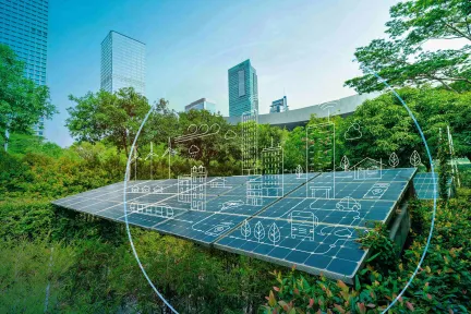
GEOVIA Geospatial Modeling brings together data from multiple sources such as geology, topography, land use, infrastructure and environmental factors into a coherent 3D GIS representation of the territory. This virtual twin transforms fragmented information into an actionable model, making it easier to interpret, use and share.
Through the 3DEXPERIENCE platform, this virtual twin becomes a common reference for BIM managers, asset managers, architects, project managers and local authority representatives. Hosted on our secure cloud infrastructure with built-in user and group access, each stakeholder can explore, combine and enrich scenarios collaboratively, ensuring decisions are based on a shared, clear and comprehensive view of the territory.
Key Benefits of GEOVIA Geospatial Modeling
Comprehensive 3D Representation
Combines diverse sources such as geology, topography, engineering and environmental data into a coherent, readable and actionable virtual twin.
Visual Clarity
Turns fragmented data into a readable and actionable virtual twin. Whatever the scale of the project, from a street to a country, you get access to the right level of detail and information.
Enhanced Collaboration
The 3DEXPERIENCE platform enables BIM managers, asset managers, architects, project managers and local authority representatives to work together on a shared platform.
Informed Decision-Making
Helps assess constraints, opportunities and long-term impacts through a clear, shared view of the territory.
GEOVIA Geospatial Modeling Roles
GEOVIA Geospatial Modeling software products are packaged as Roles to get you up to speed faster and work more efficiently with all needed applications available at your fingertips. Select a package that corresponds to your role in an organization.
FAQ
Also Discover

Process and analyze geospatial data in context

Geology Solutions for Mining and Beyond

How can sustainable cities thrive as urbanization increases?
Virtual twin experiences empower stakeholders shaping the world’s cities – from construction firms to urban leaders – to explore unlimited scenarios to optimize human experience and protect our planet. And because the twins are built on scientific principals and data, the most sustainable actions can be taken in service of and in consultation with everyday citizens: from optimizing the layout of a single building to determining the best routes for public transportation.
Delivering world-class Building Information Management (BIM) software solutions for architects, civil engineers and contractors across all project phases and trades.
Learn What GEOVIA Can Do for You
Speak with a GEOVIA expert to learn how our solutions enable seamless collaboration and sustainable innovation at organizations of every size.
Get Started
Courses and classes are available for students, academia, professionals and companies. Find the right GEOVIA training for you.
Get Help
Find information on software & hardware certification, software downloads, user documentation, support contact and services offering